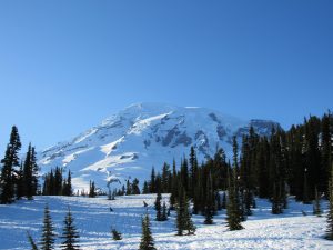
Ask anyone about South India, and the first thing that would come to their mind would either be Kerala or Tamil Nadu. Ask us, and the first on our mind would be the Kudremukh National Park. Located 95 km away from the town of Chikmagalur, this place is a paradise for both nature admirers and wildlife enthusiasts. Kuduremukha is a mountain range and name of a peak located in Chikkamagaluru district, in Karnataka, India. It is also the name of a small hill station cum mining town situated near the mountain, about 48 kilometres from Karkala and around 20 kilometres from Kalasa. The name Kuduremukha literally means ‘horse-face’ (Kannada) and refers to a particular picturesque view of a side of the mountain that resembles a horse’s face. It was also referred to as ‘Samseparvata’, historically since it was approached from Samse village. Kuduremukha is Karnataka’s 2nd highest peak after Mullayangiri. The nearest International Airport is at Mangalore which is at distance of 99 kilometres.
National park::
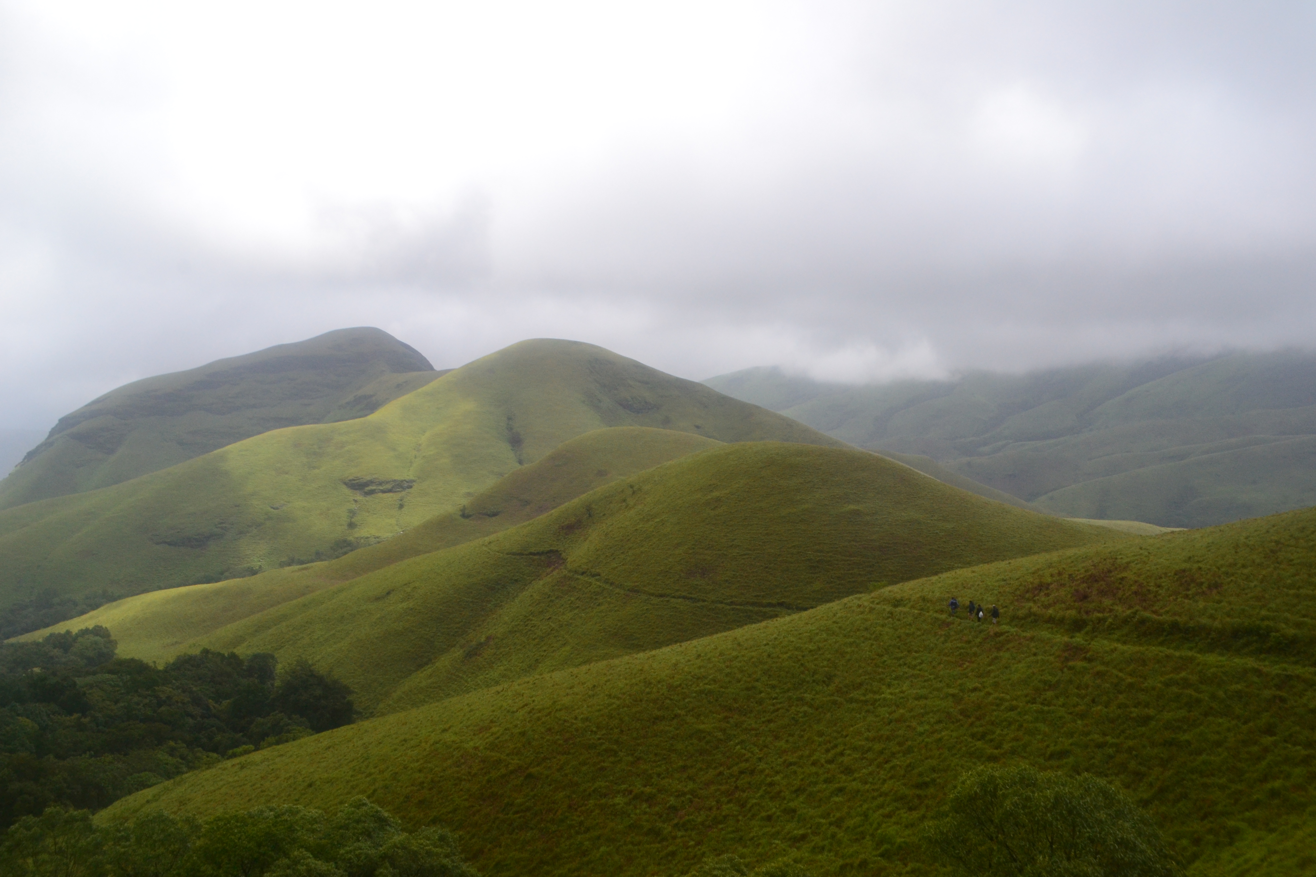
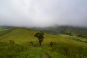
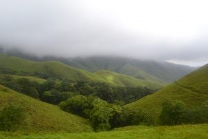
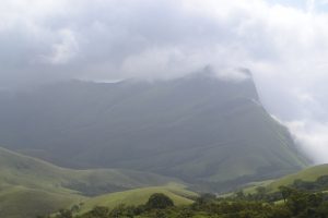
Well known environmentalist and tiger expert undertook a detailed and systematic survey of the distribution of the endangered lion-tailed macaque in Karnataka during 1983-84 with support from the Government of Karnataka. He observed that suitable and extensive rainforest habitat for the lion-tailed macaque existed in Kudremukh and that the tract probably harboured the largest contiguous population of lion-tailed macaques in the Western Ghats, outside the Malabar region. He further suggested that lion-tailed macaques could be effectively used as a ‘flagship’ species to conserve the entire biotic community in the region and prepared a conservation plan for the survival of wild populations of lion-tailed macaques in the region delineating the present national park area as a proposed nature reserve. Based on his report, the Karnataka State Wildlife Advisory Board suggested to the government that Kudremukh National Park be created. Subsequently, in 1987, the Government of Karnataka declared these reserved forests as a national park based on the above suggestion.[citation needed Kudremukh National Park is spread partly over the thick hilly forests near the coastal plains on the western portion and the shola vegetation on the Western Ghats uplands, covering parts of three districts, viz., Chickmagalur, Udupi and Dakshina Kannada. The Kudremukh peak, by which the national park derives its name, is the highest spot at 1892 meters.[citation needed] The hills, which bear the brunt of the severe monsoon winds, preclude any tree growth added to that the region is known for its rich low grade magnetite soil which primarily inhibits plant growth. As a result, the landscape is covered with grass. The valleys which are tucked in, have reasonable protection from wind and a deep soil profile, as a result of which stunted evergreen forests exist creating a unique microclimate, rich with mosses, orchids, etc. The whole scenery of grassland interspersed with narrow strips of forests provides a fantastic vista. Three important rivers, the Tunga, the Bhadra and the Nethravathi are said to have their origin here. A shrine of goddess Bhagavathi and a Varaha image, 1.8 m within a cave are the main attractions. The Tunga River and Bhadra River flow freely through the parklands. The area of the Kadambi waterfalls is a definite point of interest for anyone who travels to the spot. The animals found there include malabar civets, wild dogs, sloth bears and spotted deer.
Best Time To Visit Kudremukh::
•Kudremukh in Summer (March – June) March to May period sees some of the best weatherconditions in Kudremukh. •Kudremukh in Monsoon (July – September) Till late October, Kudremukh receives heavy rainfall making the hill town perfect for capturing its off-beat beauty. … •Kudremukh in Winter (October – March)